
A team of researchers are using aerial scanning technology to study Teotihuacán, the sprawling ancient city built over a thousand years before the Aztecs’s arrival in Mexico whose construction remains a mystery. Their findings, summarized in a paper
published in the scientific journal PLOS One this week, illuminate the ways in which the site’s original inhabitants modified the landscape and shaped the modern layout of the region. “Our current landscape is a palimpsest of past actions,” Nawa Sugiyama, an anthropologist at the University of California Riverside and the study’s lead author, told Hyperallergic. “The ancient city of Teotihuac án buried deep underground continues to influence our daily lives, from the orientation of our roads to constructing our walls. It is a heritage landscape.” Aided by the first LiDAR map of the Teotihuac án Valley, the authors built a geospatial database that analyzes modern and topographic features in relation to ground survey and excavation data. A revolutionary tool for conducting non-intrusive archaeological surveys, LiDAR (short for “light detection and ranging“) employs laser sensors to map and measure objects and structures that might be invisible to the naked eye.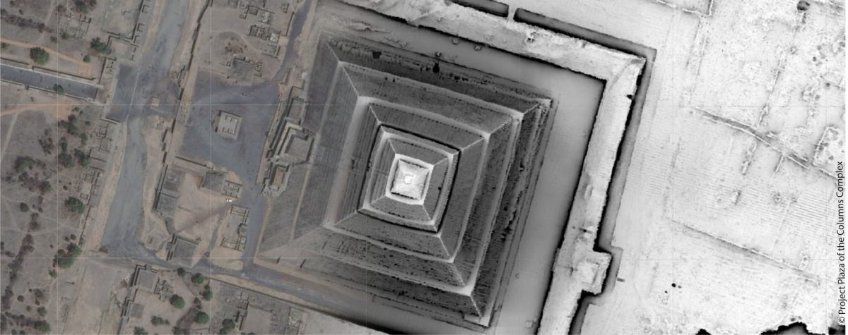
The team found that 65% of urban features today are aligned orthogonally within three degrees of 15 degrees east of astronomical north, the orientation of Teotihuacán, selected by engineers for its cosmic significance. The first residents of the largest ancient city in the Americas moved “immense” quantities of soil, sometimes quarrying the bedrock itself to use as construction material, and re-routed two major rivers, the Rio San Juan and the San Lorenzo River.
“As human dwellers interact and engage with a landscape, their activity molds a ‘taskscape’ into the solid physical environment,” the authors write. “Past decisions and actions thus often persist as topographic features layered onto the terrain.”In addition, the researchers discovered that 205 features from the ancient city were destroyed by industrial bedrock mining, undertaken for the aborted construction of an international airport in 2015.
“Already, we have recorded not only new features previously unrecognized by historic surveys, but also the complete erasure of archaeological features due to modern (post-2015) mining operations,” says the study. The LiDAR map is “
the only historical record of many archaeological features no longer available for study.”“
The only way to preserve many of the archaeological features is via digital archiving and monitoring of heritage landscapes as we are increasingly overwhelmed by the immediate urbanization and resource crisis we face that affect vast areas with unprecedented speed across the globe,” the researchers conclude.


0 Commentaires